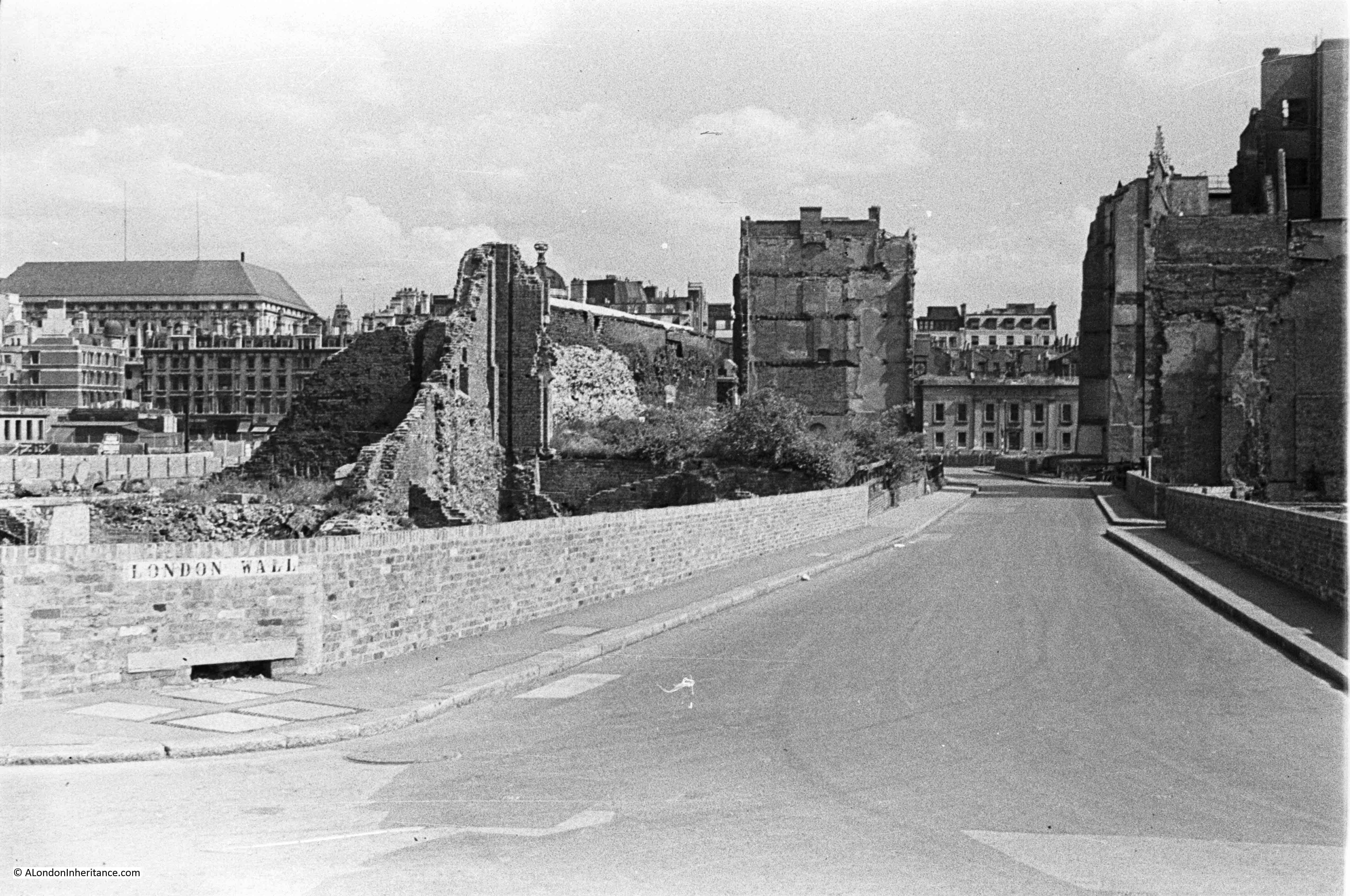
For this week’s post, I am back to tracing the locations of my father’s photos, and this photo dates from 1947. Locating the photo is helped by the street name, London Wall being displayed on one of the low walls built to separate street from bomb damaged buildings. Much of London Wall today is a very different place, not only with the buildings that line the street, but also the location of the street.
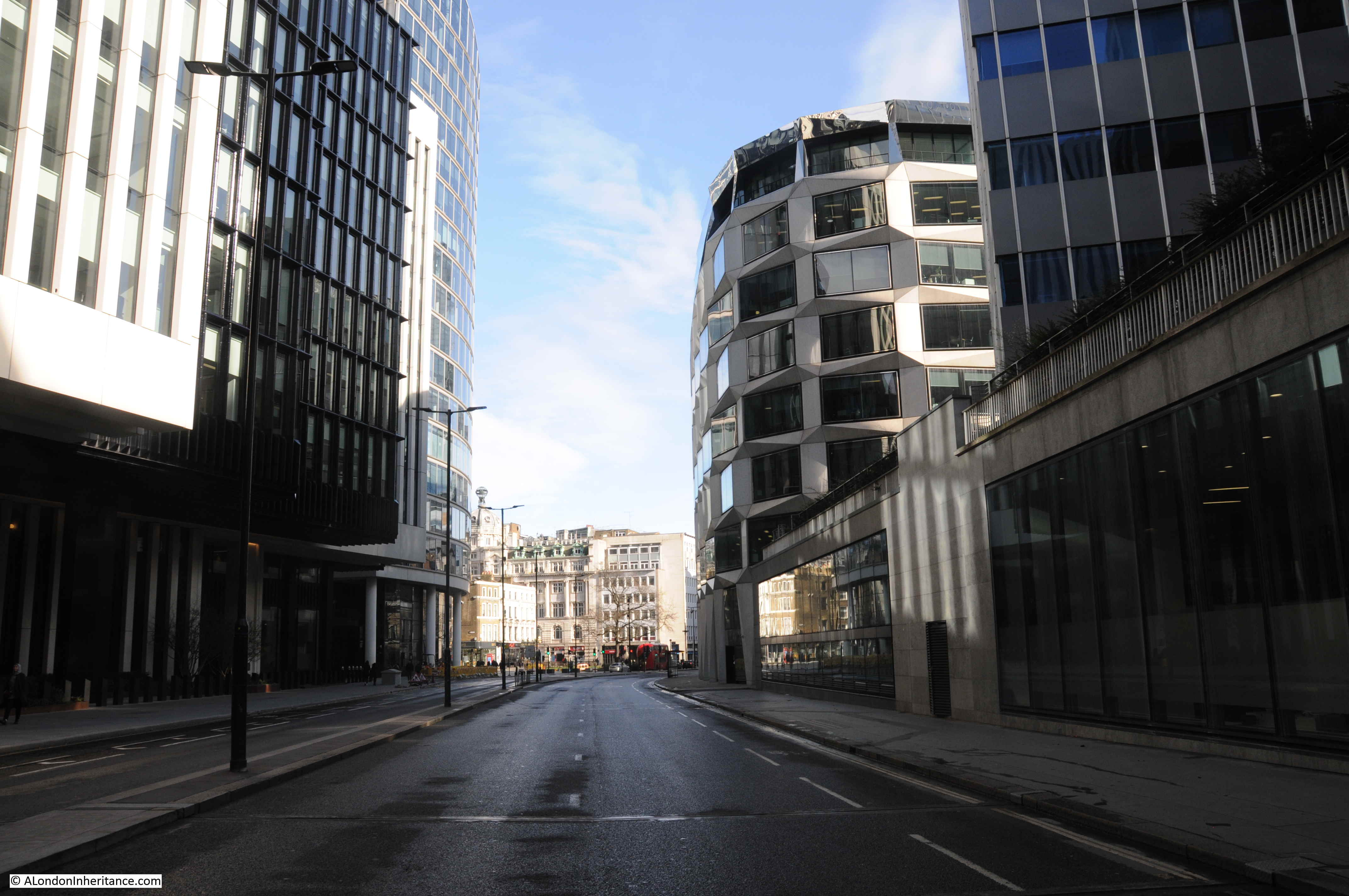
This is roughly the same scene today, in 2020:
There are a couple of features in the 1947 photo which help to confirm the location. I have ringed the first of these features in extracts from the 1947 and 2020 photos below:
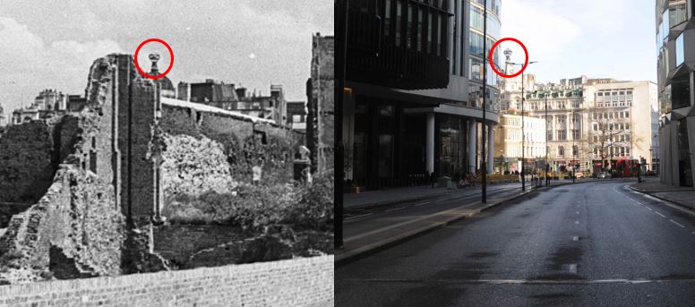
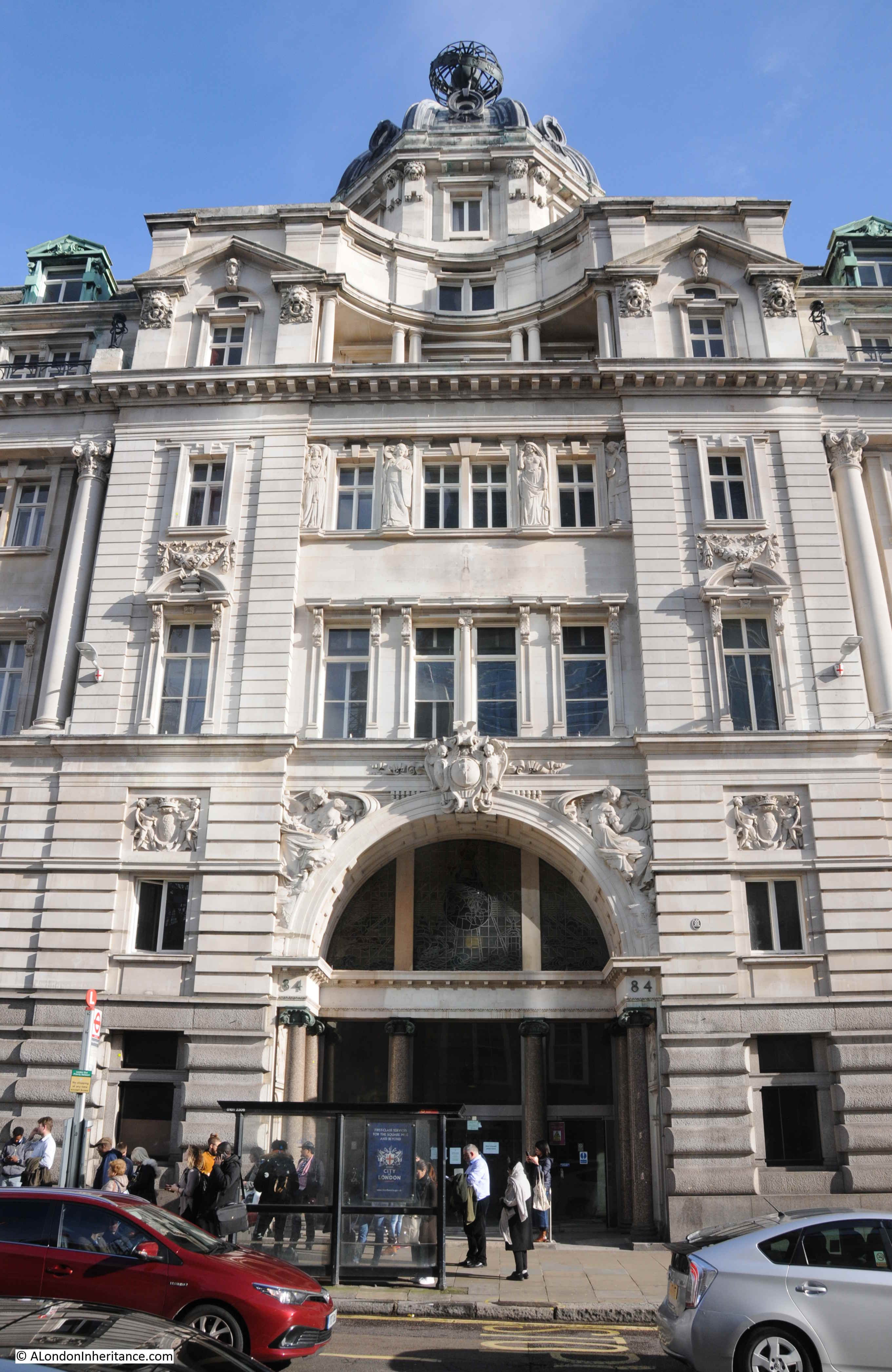
This feature can be found on top of the magnificent number 84 Moorgate, or Electra House, built in 1903 for the Eastern Telegraph and Allied Companies, one of the early telecommunications companies that built cable networks across the world.
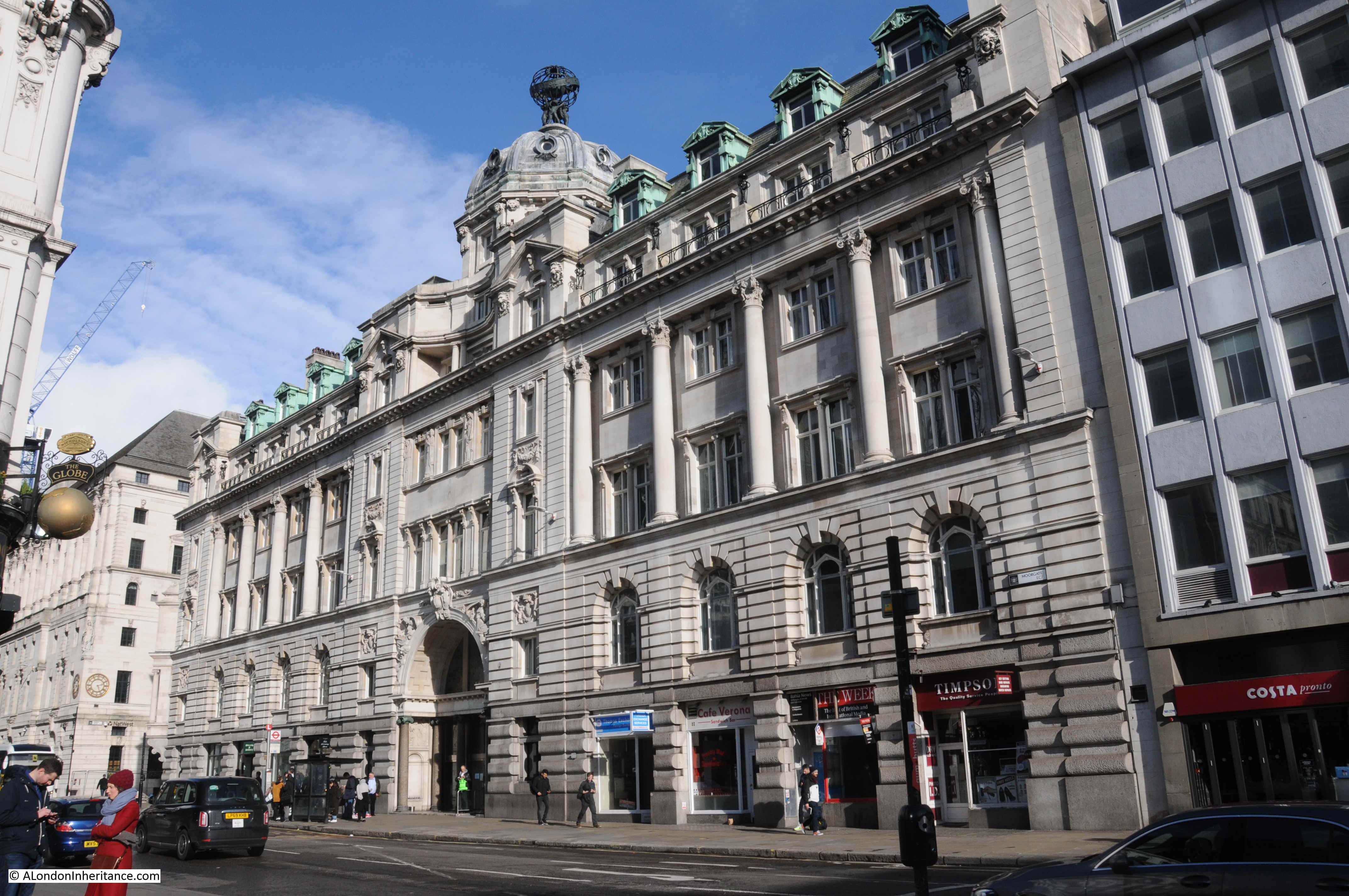
The two storey entrance to the building, with the dome at the top, and the feature that can be seen in my father’s 1947 photo.
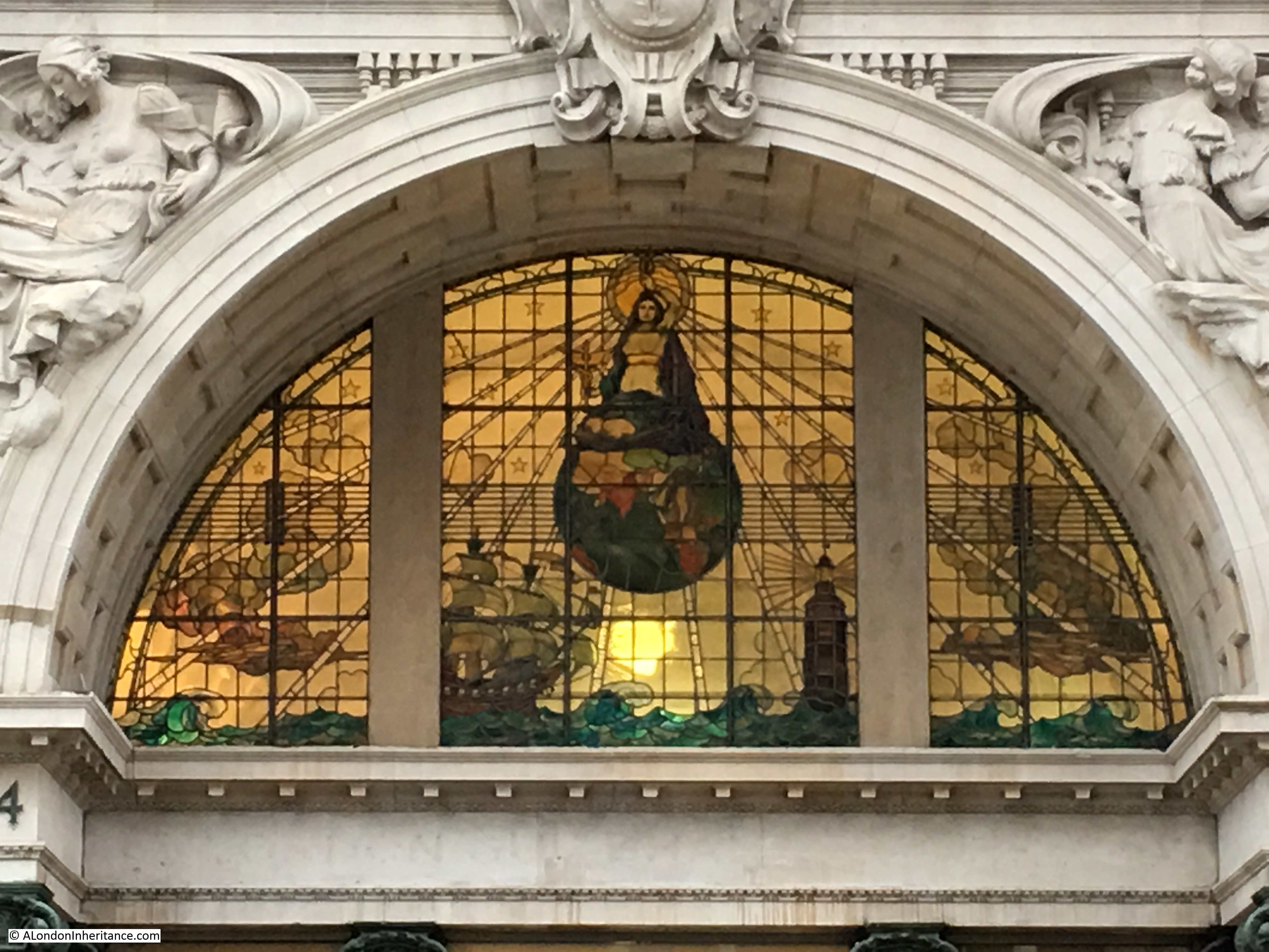
Above the main entrance is this magnificent coloured glass. A figure sits on top of the world, with a glowing orb above her head which sends rays across the seas, where a sailing ship and lighthouse can be seen. Eastern Telegraph was responsible for the installation and operation of a number of sub-sea communications cables that gradually connected the continents, so I suspect the glass mural in some way represented sub-sea cables shedding light across the world by providing the means for instant communications.
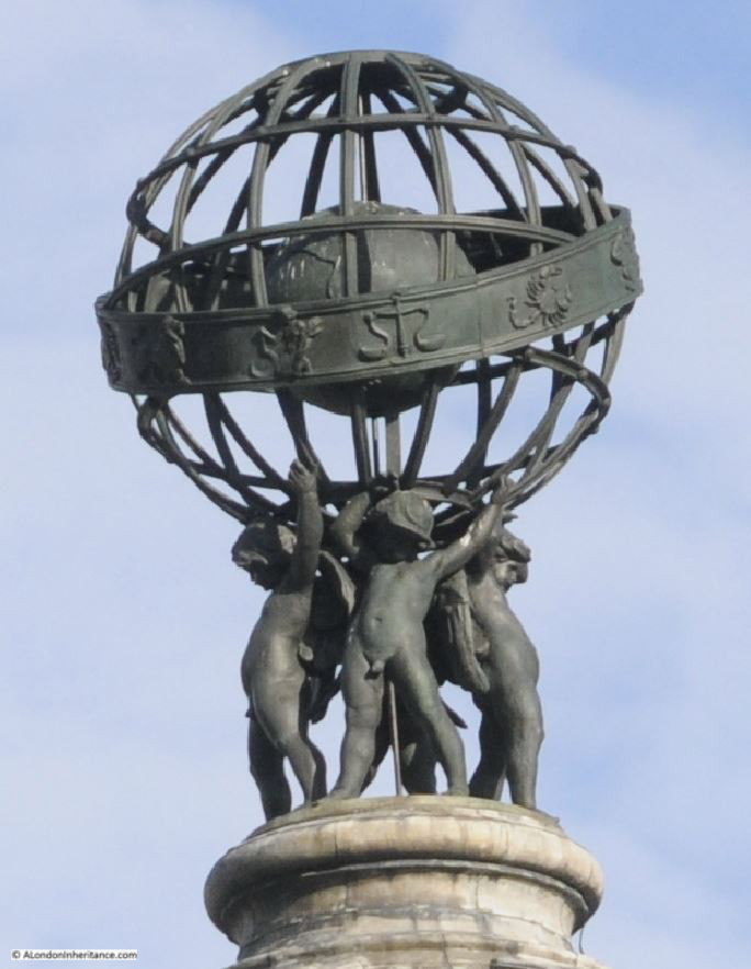
The feature at the very top of Electra House, and visible from London Wall is in the photo below. For a company that was involved with technologies leading the global communications revolution, I was surprised to see the signs of the zodiac surrounding the world.
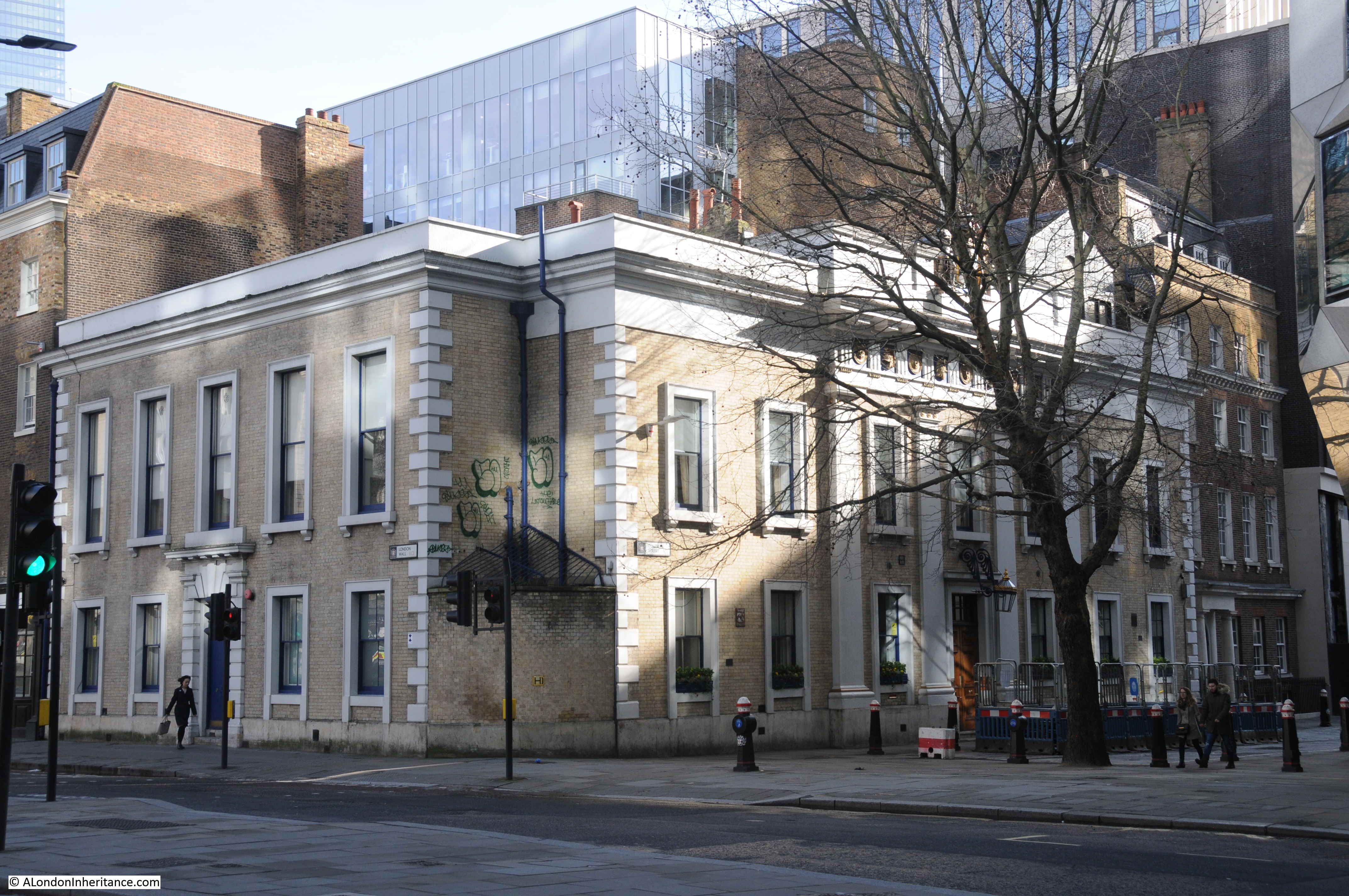
The second feature that helped to identify the location is this two storey building seen at the end of the section of London Wall shown in the 1947 photo.
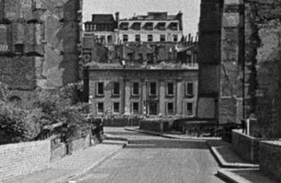
Although only visible when you are near the building today, as new developments along London Wall have hidden the building from view along much of the street, the building still exists today.
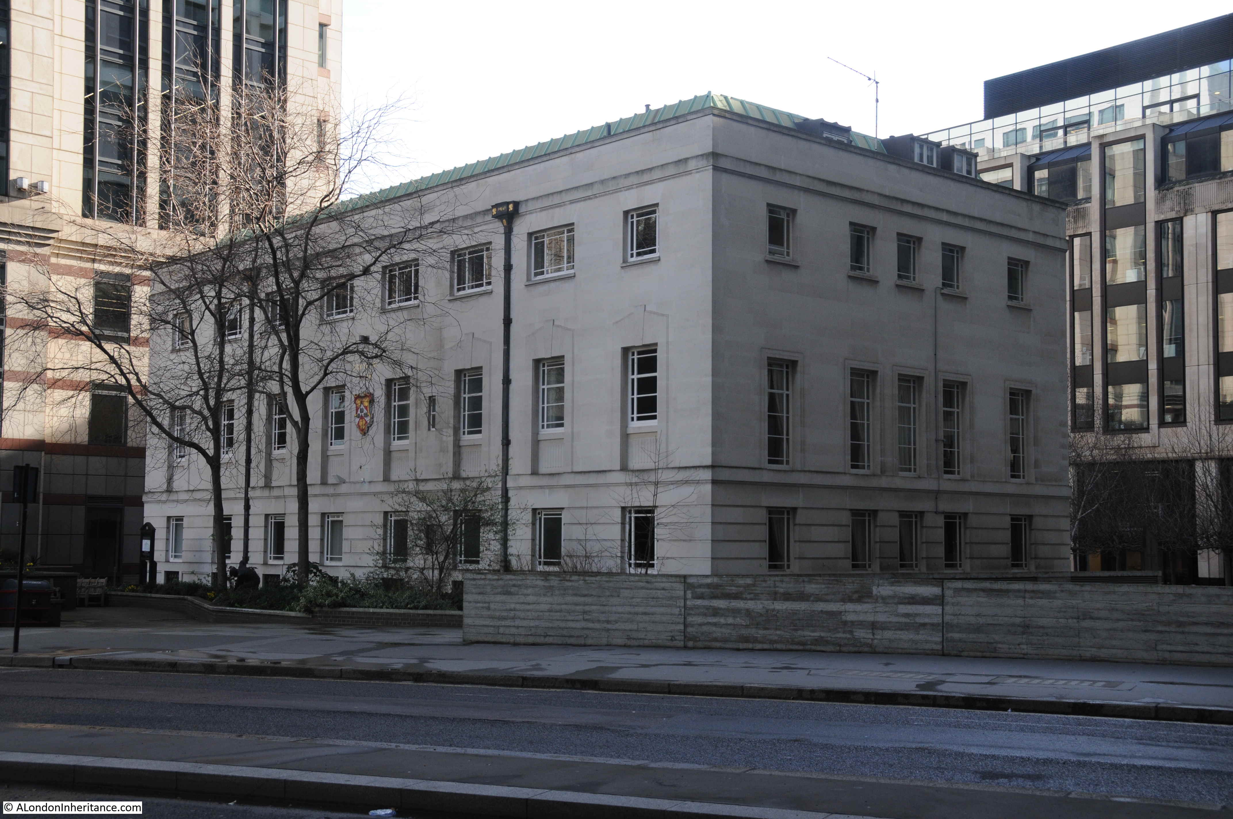
It is the Armourers’ Hall of the Armourers and Brasiers’ Company, a rather nice Georgian building in the neo-Palladian style. Due to new buildings, I could not photograph the Armourers’ Hall from the same direction as in my father’s photo, so this is the view looking across London Wall.
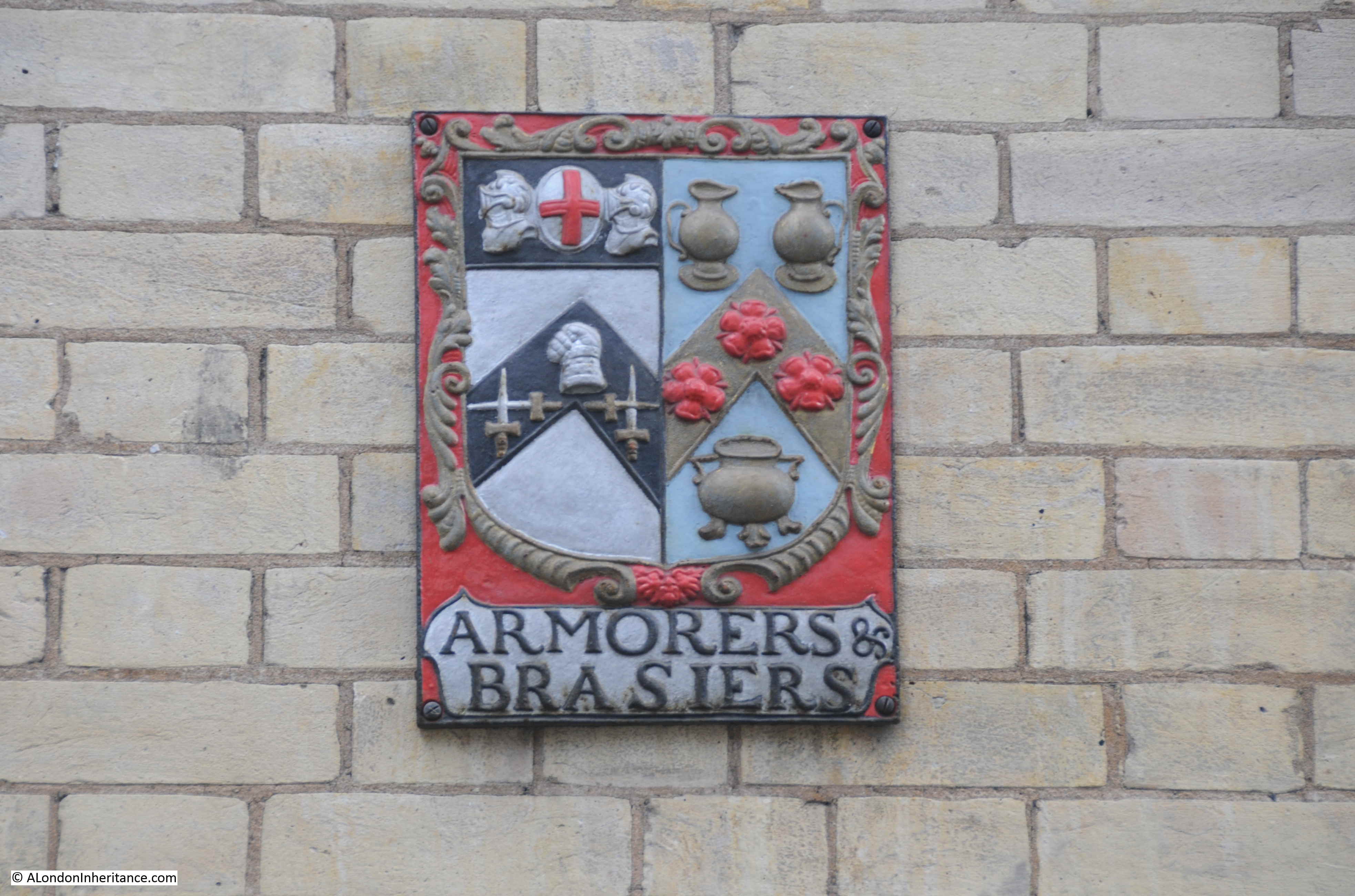
The Armourers and Brasiers Company was formed in 1322 by a number of craftsman looking to maintain standards in the manufacturer or craft of armour.
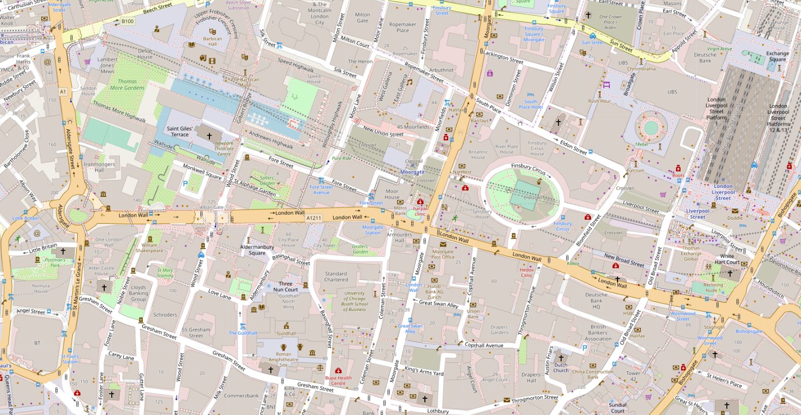
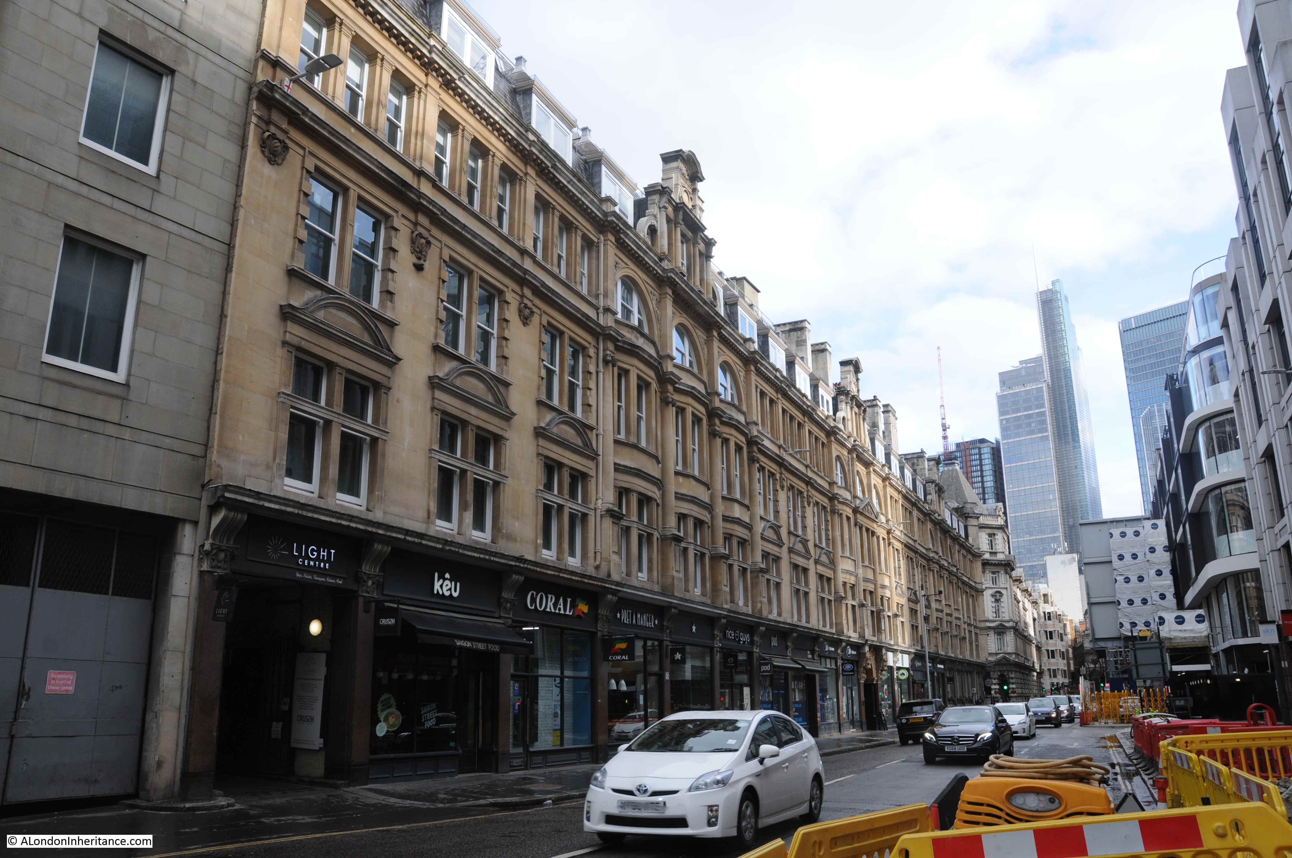
London Wall is two very different streets. The section of London Wall west of Moorgate is a wide dual carriageway, leading from the roundabout with the Museum of London at the centre at the junction with Aldersgate Street. East of the Moorgate junction, London Wall is a narrower street with many pre-war buildings still lining the street.
The following map shows the location of London Wall today, running left to right along the centre of the map, with the roundabout that forms the junction with Aldersgate Street on the left (Map © OpenStreetMap contributors).
The area between Moorgate and Aldersgate Street suffered terrible damage during the war. A large part would be redeveloped as the Barbican Estate, and a major change was made to London Wall. From just west of Moorgate, the road was diverted to a new southerly routing to a large new roundabout.
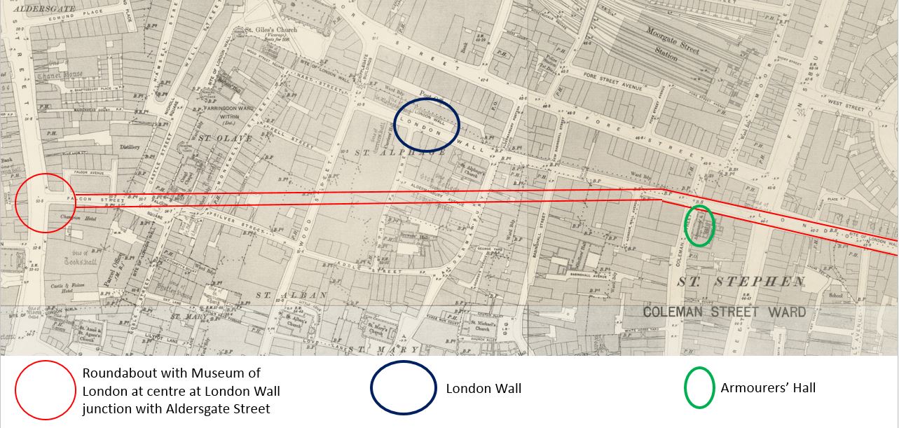
in the following map extract, the original route of London Wall can be seen coming from the right then moving diagonally up along the map. I have marked the first third with red lines.
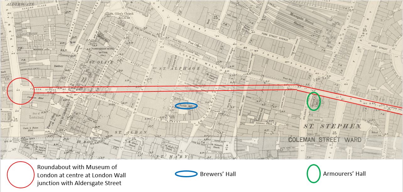
A third of the distance along, the new London Wall then takes a completely new direction, carving the new dual carriageway through a series of old streets and buildings, many of which had been badly damaged by wartime bombing.
The location of Armourers’ Hall is the green circle on the right. To the left, the red circle is the new roundabout that forms the junction with Aldersgate Street and is the location of the Museum of London. In the centre, there is another landmark that helps confirm the location. This is Brewers’ Hall, set back a short distance from London Wall, with the original, smaller hall shown as the blue oval in the above map.
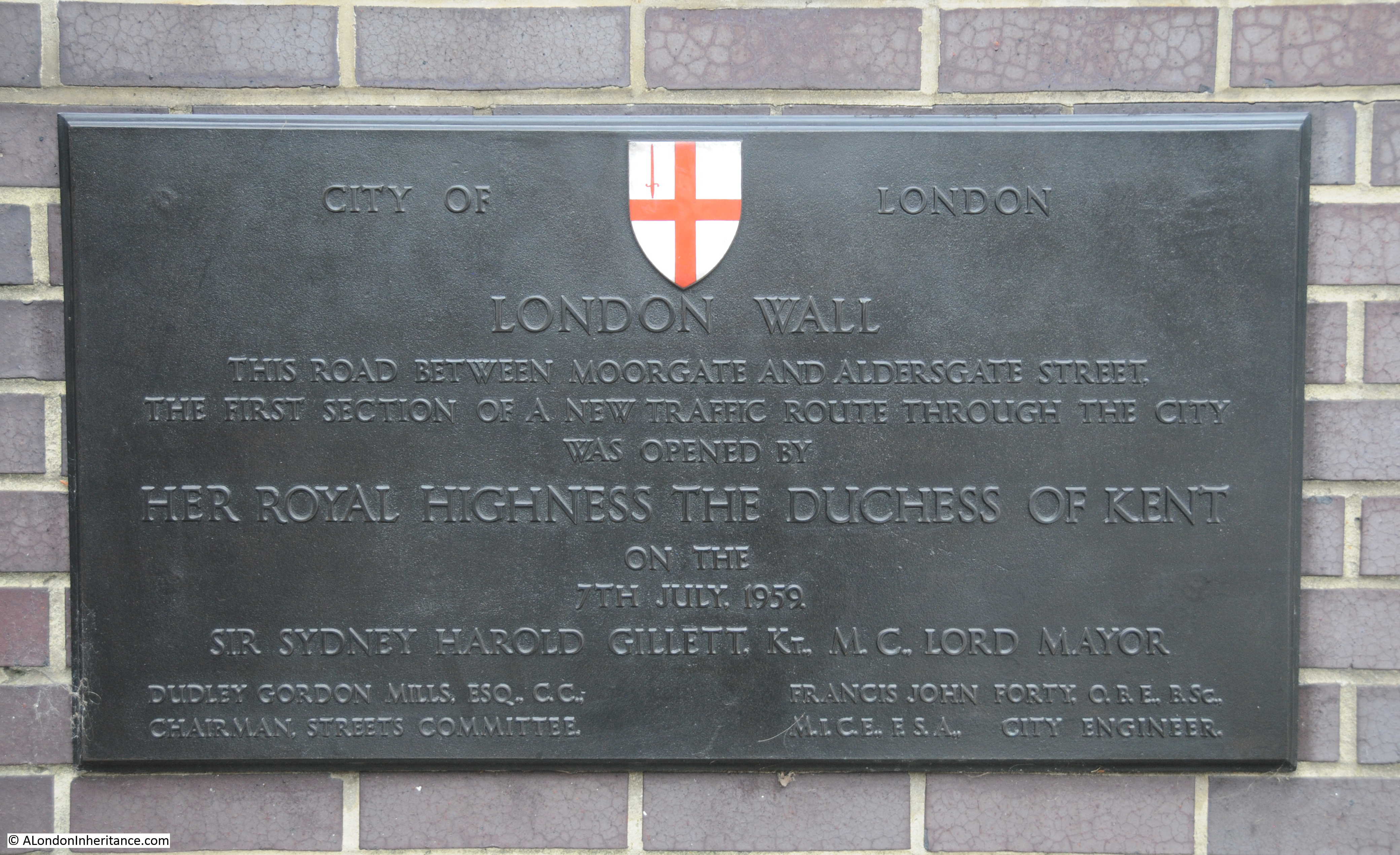
This new section of London Wall between Aldersgate Street and Moorgate Street was opened on the 7th July 1959. As the plaque shown in the following photo indicates, this was intended to be the first part of a major new traffic route through the City of London. A due carriageway providing a northern, east to west route, with the planned Upper and Lower Thames Street providing the southern, east to west route.
The new dual carriageway would be lined with new office tower blocks, and the planned Barbican to the north would be the future of City residential living. This was how post war City planning was based on the assumption that car travel would be the future and City streets were needed that provided easier traffic flow, with pedestrian walkways above the streets separating pedestrians from traffic.
Fortunately, the full east and west extensions of the new London Wall did not get built, although part of the eastern stretch of the street was extended to dual carriageway, but not as drastically as the western section.
The differences between the two sections of London Wall can best be seen by taking a walk along the complete length of the street. This is the start, looking at the roundabout junction with Aldersgate Street, with part of the Museum of London in the centre of the street.

From the junction with Aldersgate Street, we can look east along London Wall, a view which clearly shows a wide dual carriageway, designed to carry large amounts of traffic, quickly through the City.
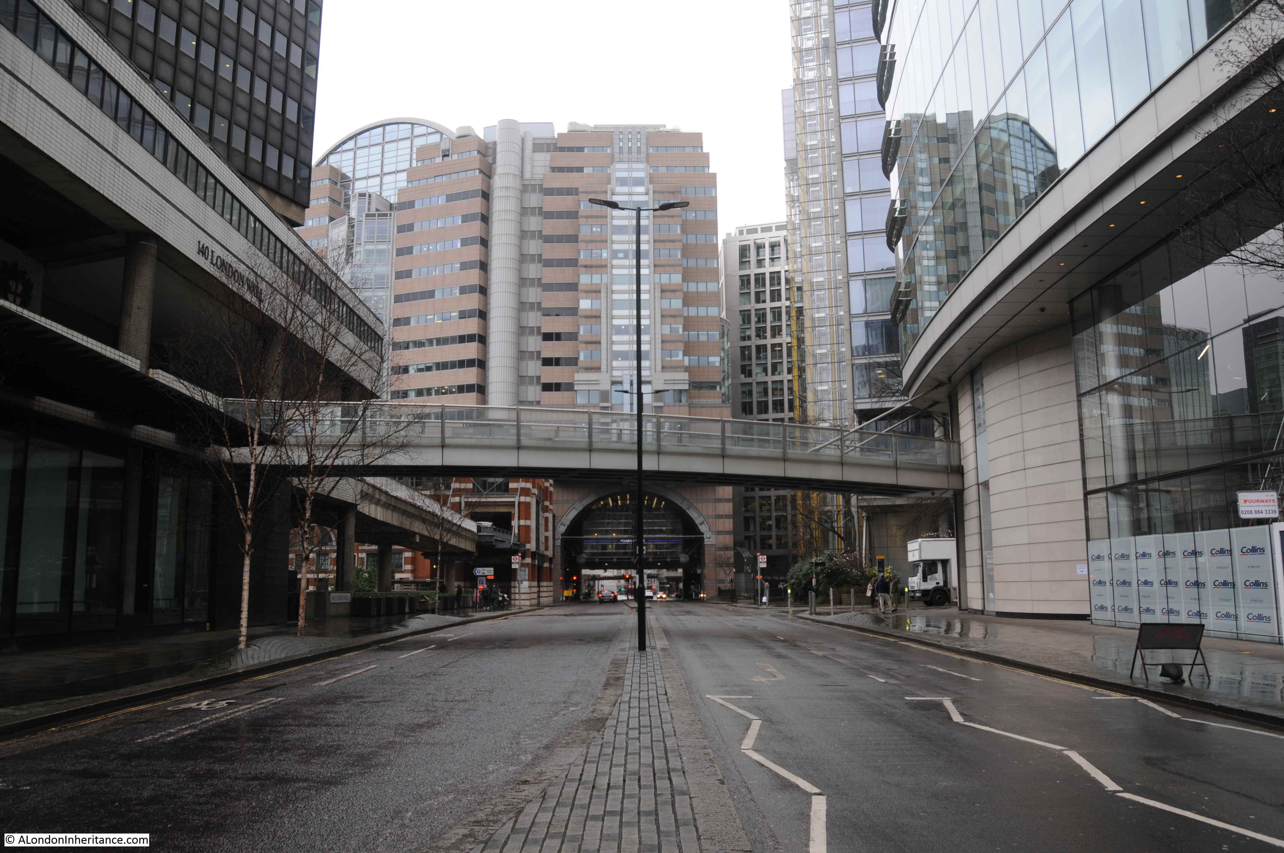
The buildings that line London Wall, and occupy space over the street are the second incarnation of office blocks along this street, having largely replaced the 1950s / 1960s office blocks that originally lined either side of London Wall.
London Wall was designed specifically for the car, and this can be seen both above and below ground.
Underneath London Wall is a large underground car park operated by the City of London. The car park runs for a large part of the new section of London Wall. The photo below was taken roughly underneath the lamp-post in the above photo.
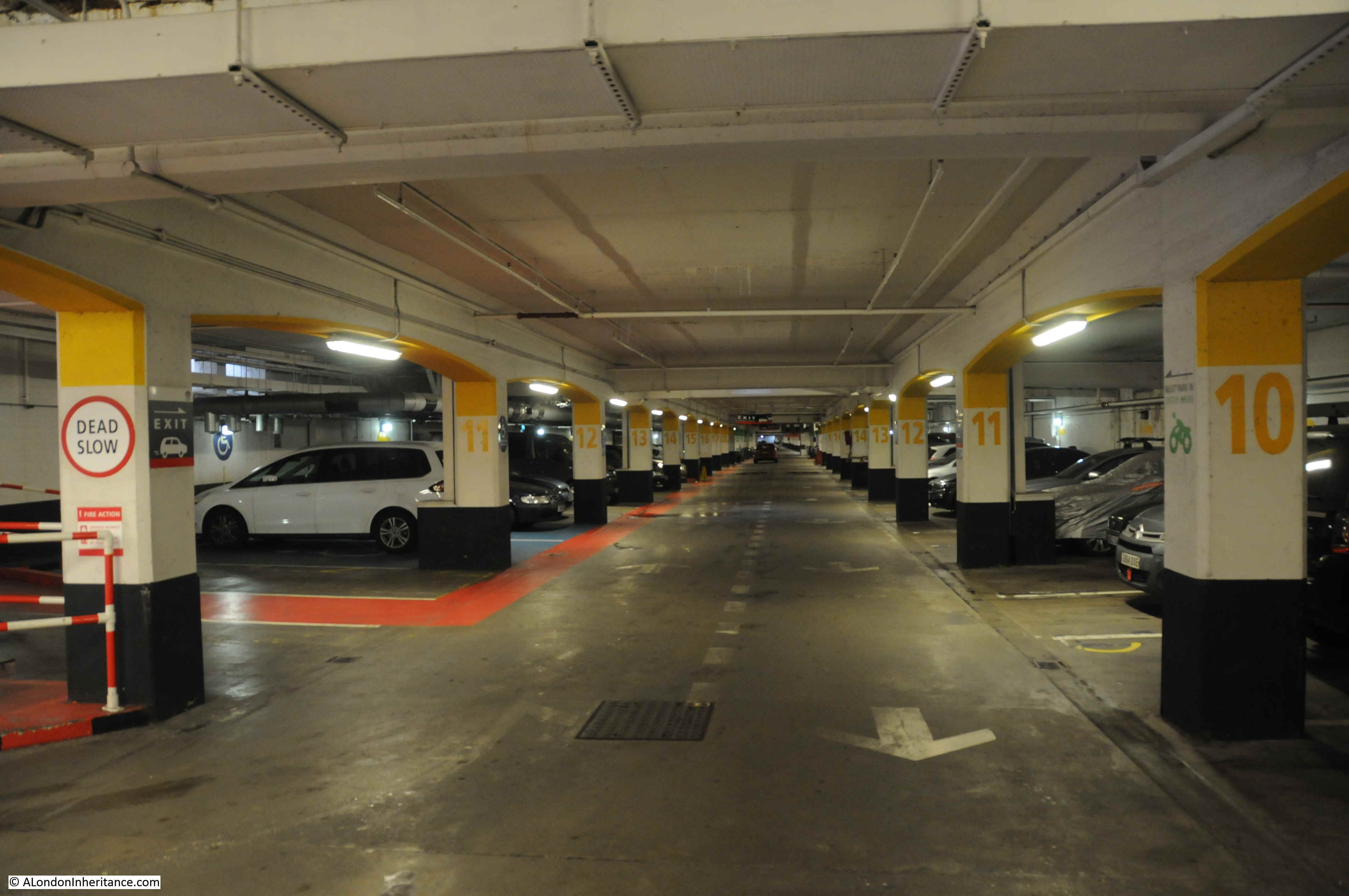
There is a section of the original London wall in the car park – a subject for another post.
The majority of the space either side of London Wall is occupied by gleaming new glass and steel office blocks. One exception are the ruins of the tower of the church belonging to the medieval hospital of Saint Elsyng Spital.

The new office blocks that line London Wall are not just tall, they occupy large areas of land, and dwarf older building such as Brewers’ Hall which can be seen in the lower right of the following photo.
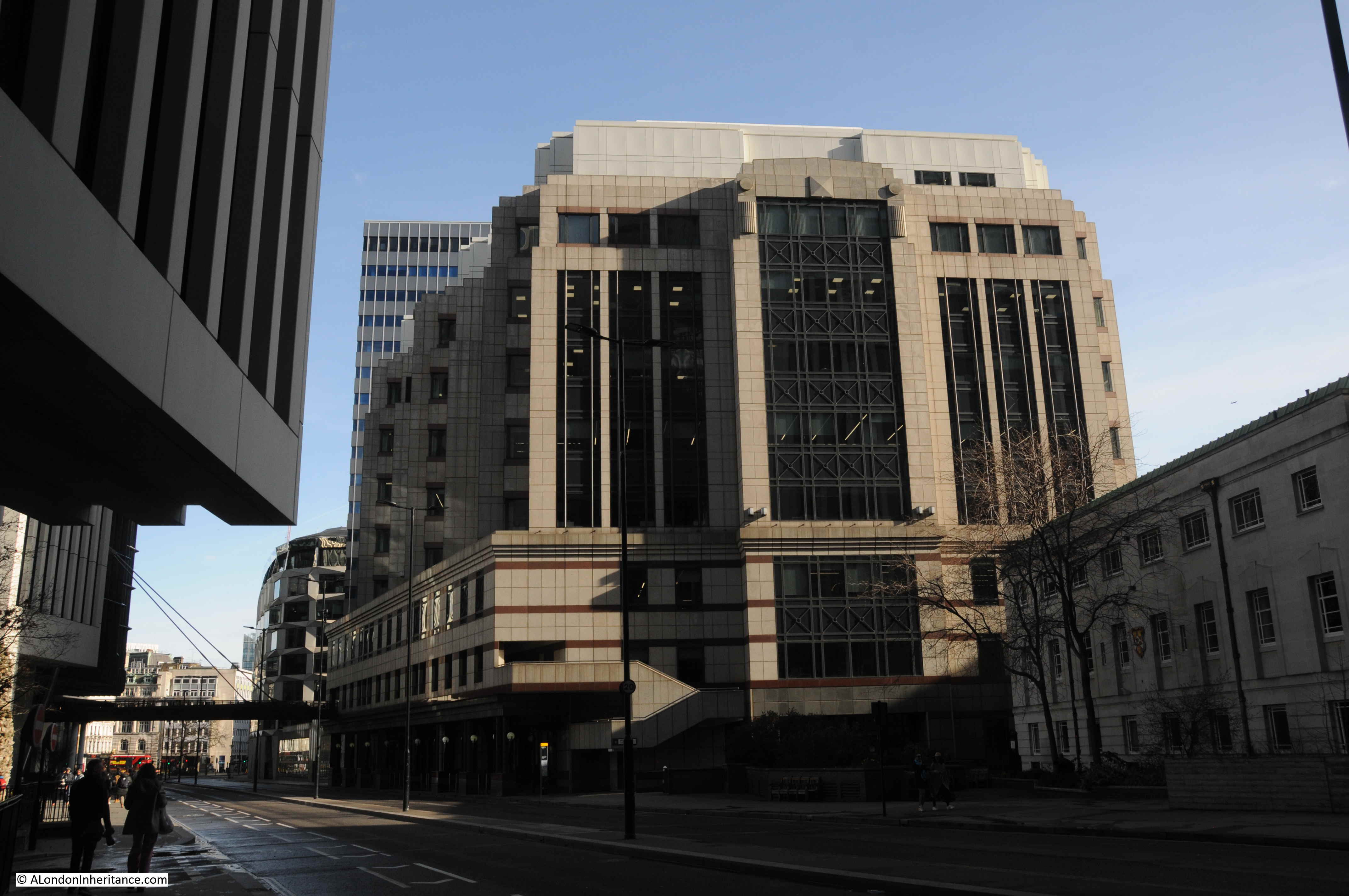
The building in the following photo is the one that obscures the view of Armourers’ Hall, which is located just behind the building, where Coleman Street meets London Wall (although traffic access between the two streets is now blocked by a pedestrian route along London Wall).
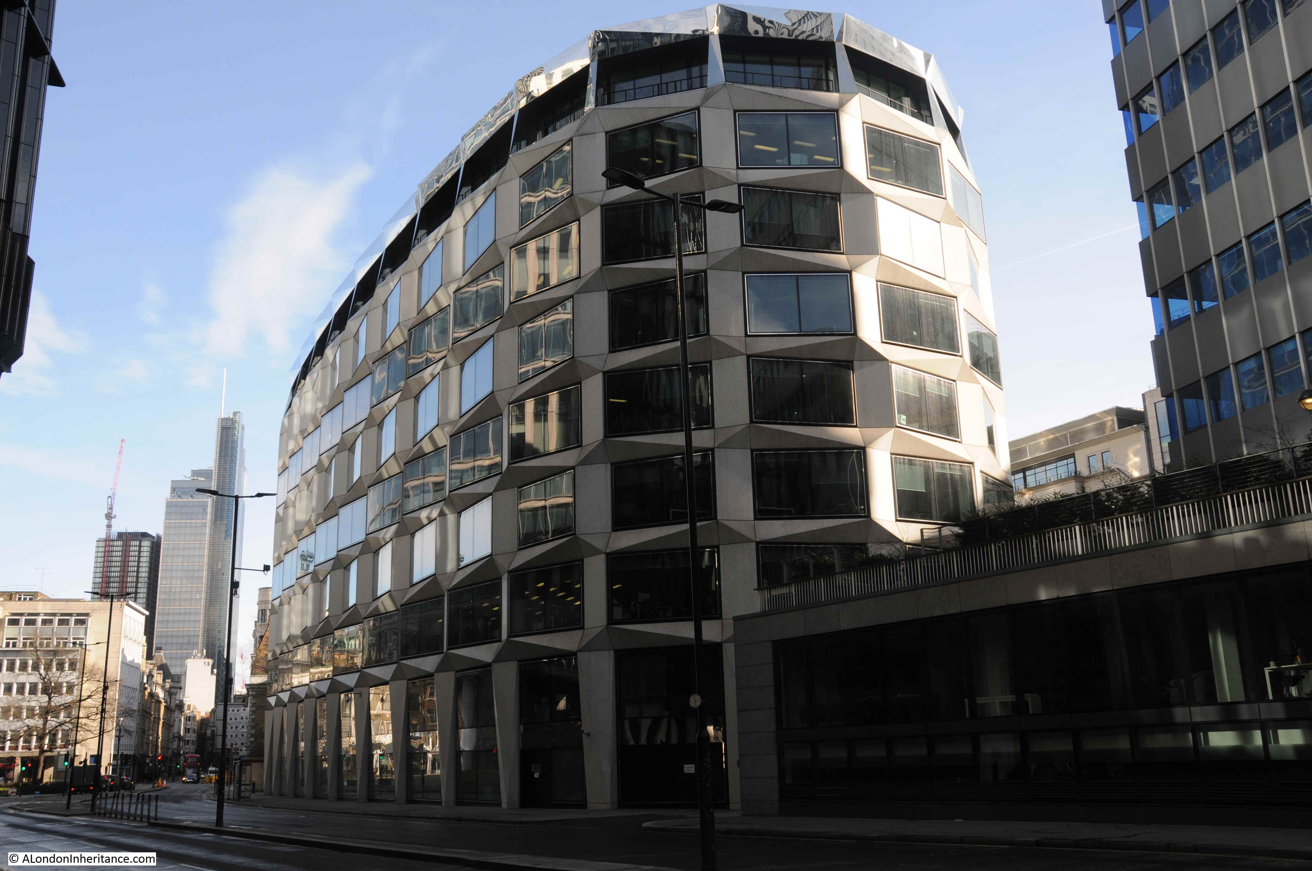
Nearing the junction of London Wall and Moorgate, where London Wall continues into the heart of the City as indicated by the gleaming towers in the background.

From London Wall, we can look across to Moorgate, and set back from the road is this row of buildings, with a large pedestrian area and small green space between the buildings and London Wall, which help show how the area has changed.
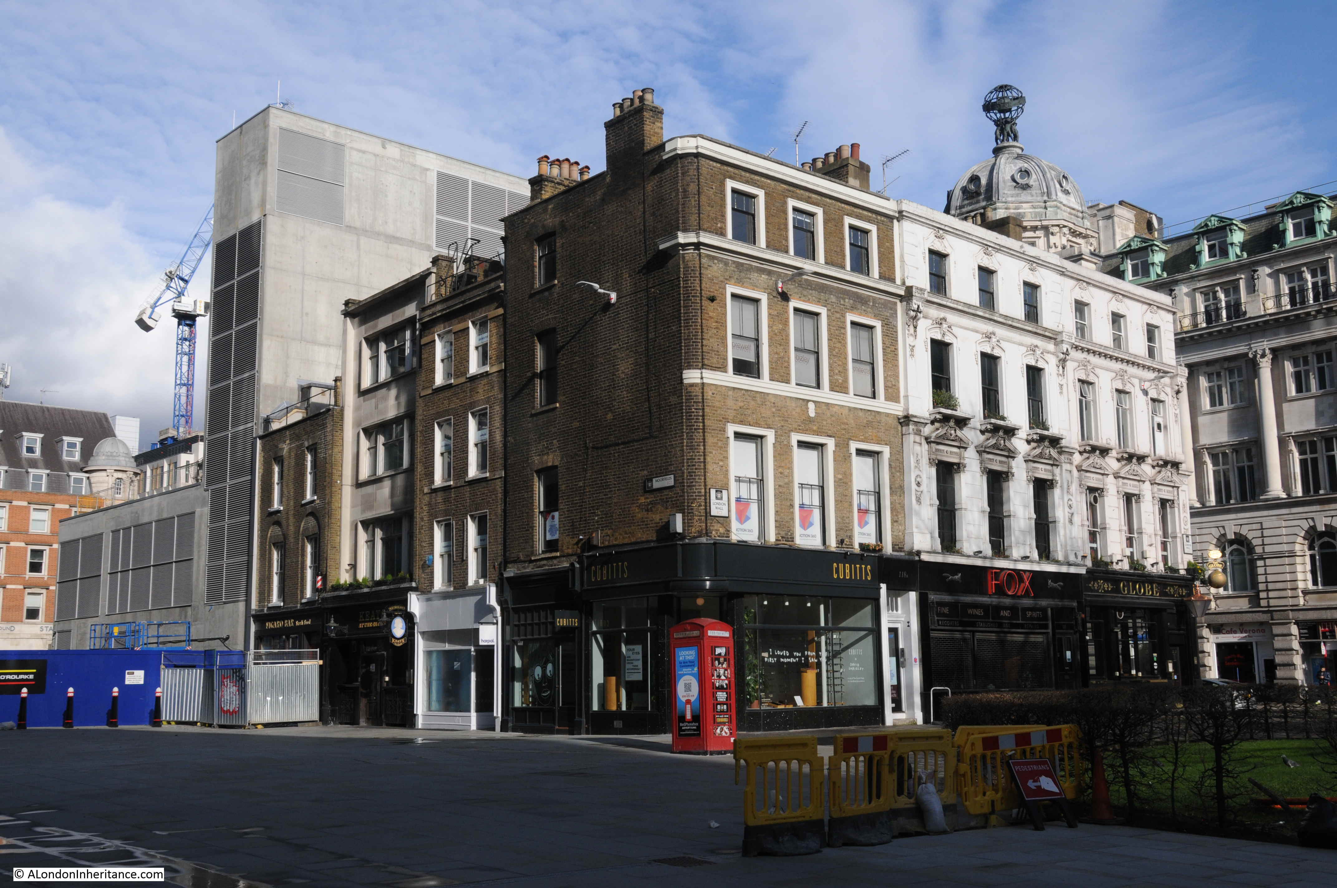
The building on the right of the terrace is a pub, the Globe, and this pub, and the other two buildings that make up this terrace can be seen in the map extract below.
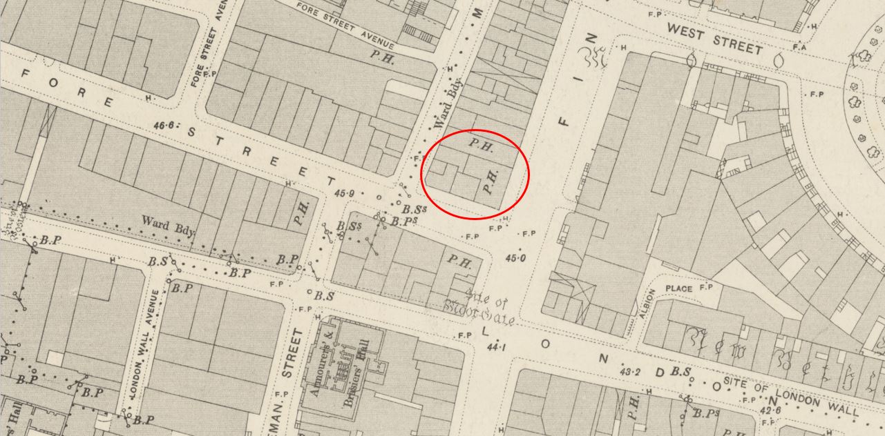
Credit: ‘Reproduced with the permission of the National Library of Scotland’
These buildings were originally on Fore Street, a street that once ran all the way up to St Giles Cripplegate. Fore Street has been shortened and blocked of by one of the new buildings alongside London Wall.
Fore Street ran just north of the original alignment of London Wall, and we can still walk part of the original route.
I have ringed a section of the original route of London Wall in the following map extract. Just above the word London, is a small space with the words London Wall.
This is the section of Roman Wall in St Alphage Gardens, shown in the following photo:

This section of wall helps explain why the street is called London Wall, as the street originally ran along the wall, just inside the City.
The following photo is looking west along what was the street London Wall, the section of wall at St Alphage Gardens can just be seen to the right.
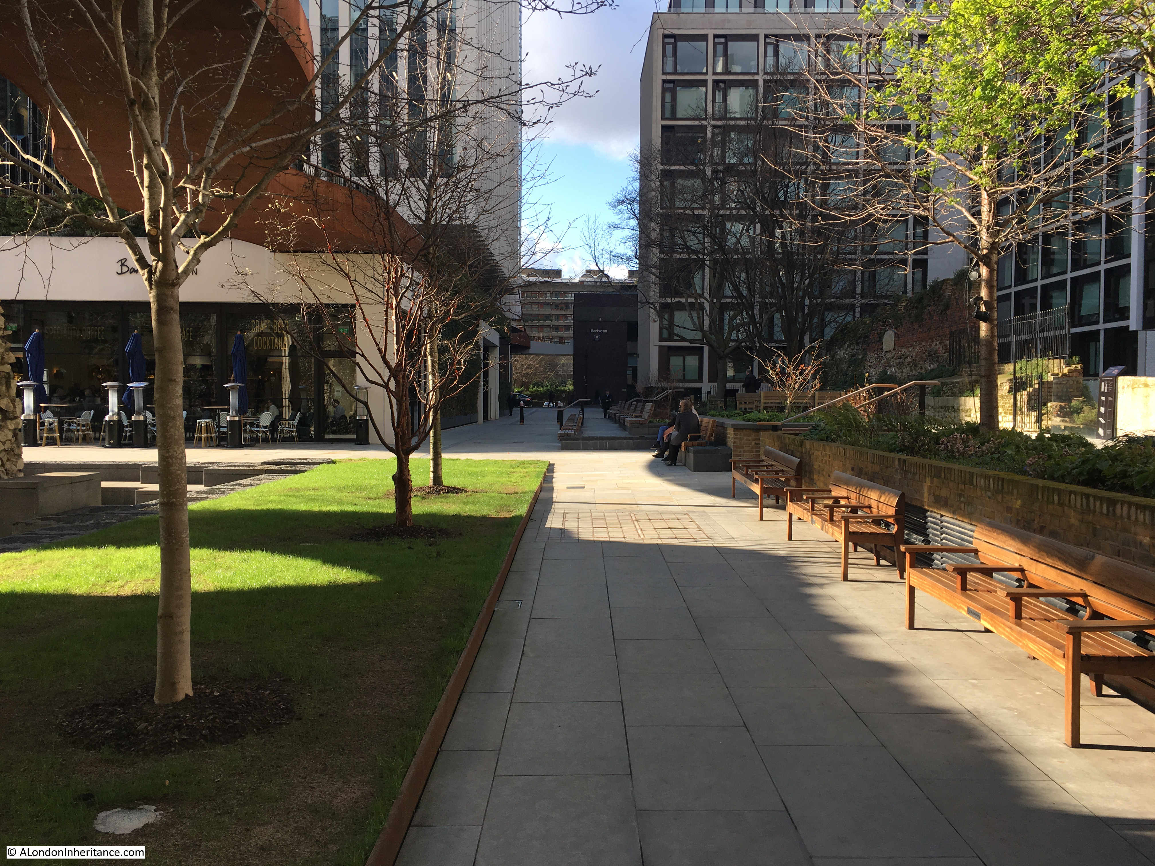
The following photo is looking along St Alphage Gardens, what was London Wall, from the junction with Wood Street.
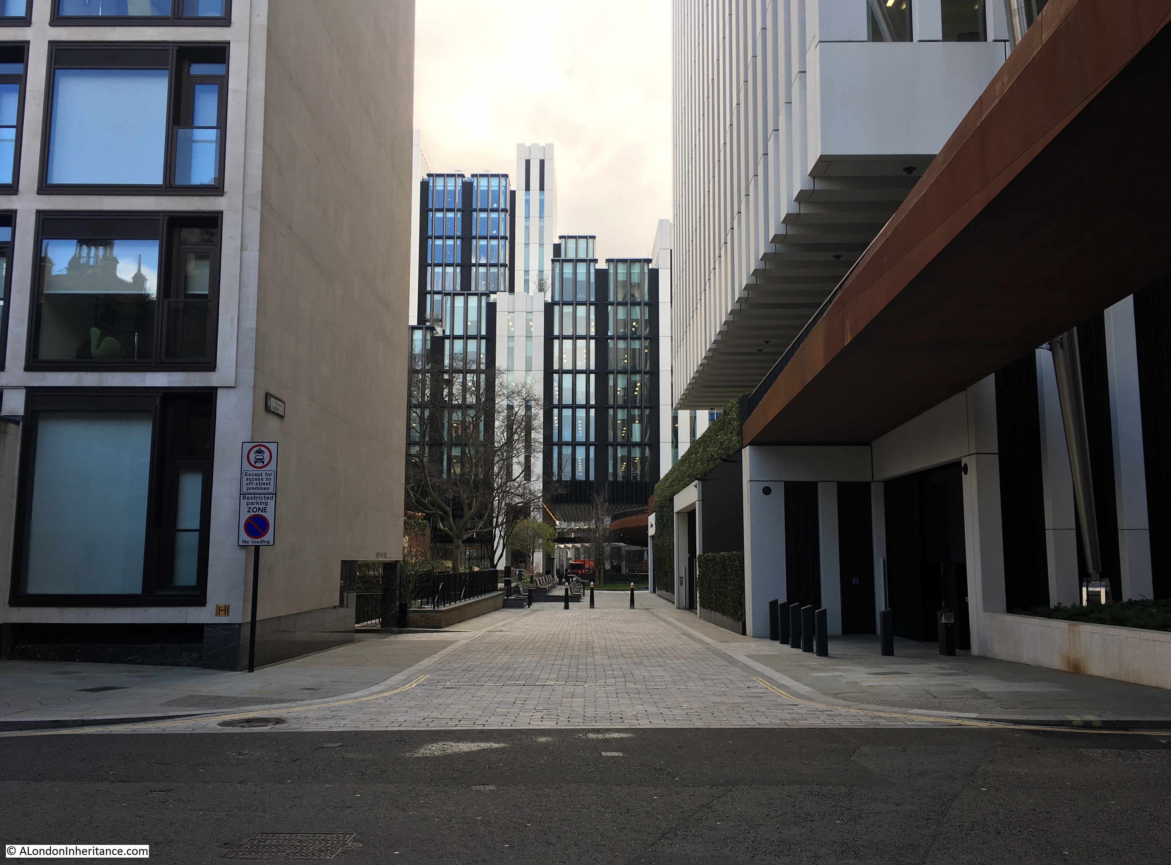
The above photo highlights one of the things I find fascinating about the city. Despite the amount of change, you can still trace out many lost streets, and although London Wall has been widened and moved to the south, we can still find the original junction with Wood Street and the original route down to Moorgate.
Returning now to the junction of London Wall and Moorgate, and the three houses on the left that once faced onto Fore Street, this is the old Fox umbrella shop.
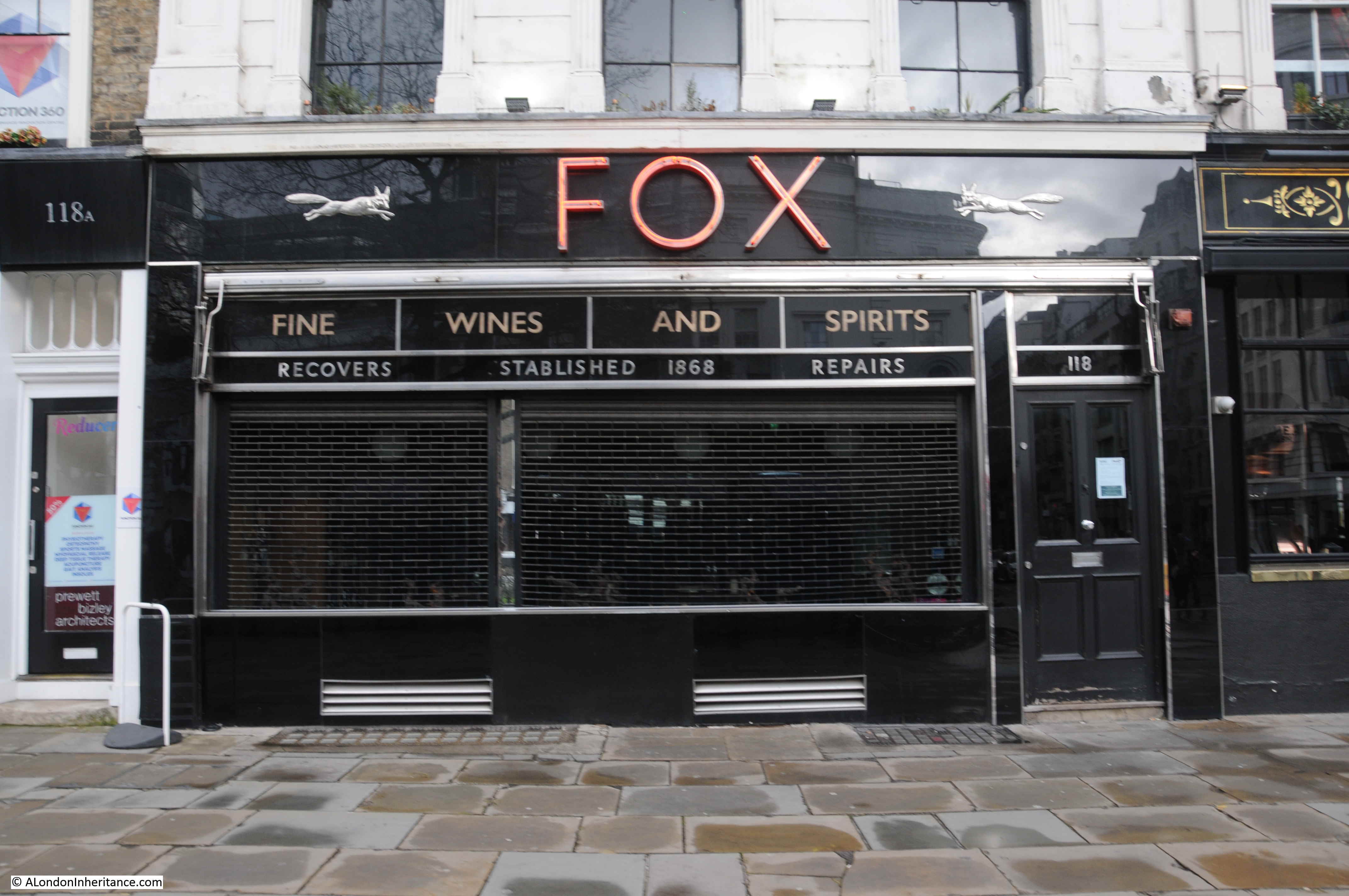
Now Grade II listed. Thomas Fox first opened an umbrella shop in Fore Street in 1868 and umbrellas were both made and sold on the premises for many years.
The wording below the FOX sign give an indication of the business at the site today, however Fox Umbrellas are still being made and sold from the company’s new location in Shirley, Croydon.
Now lets continue along the street, east of the Moorgate Junction, and this is the original London Wall with a much narrower street and still with many pre-war buildings. Thankfully the original scheme to extend the dual carriageway of the moved length of London Wall was never carried out in full.
We have already seen the halls of the Armourers and Brasiers’ Company and the Brewers’ Company, and there is a third hall along London Wall. In the photo below, on the right, the building with the Corinthian Pillars is the hall of the Carpenters’ Company.
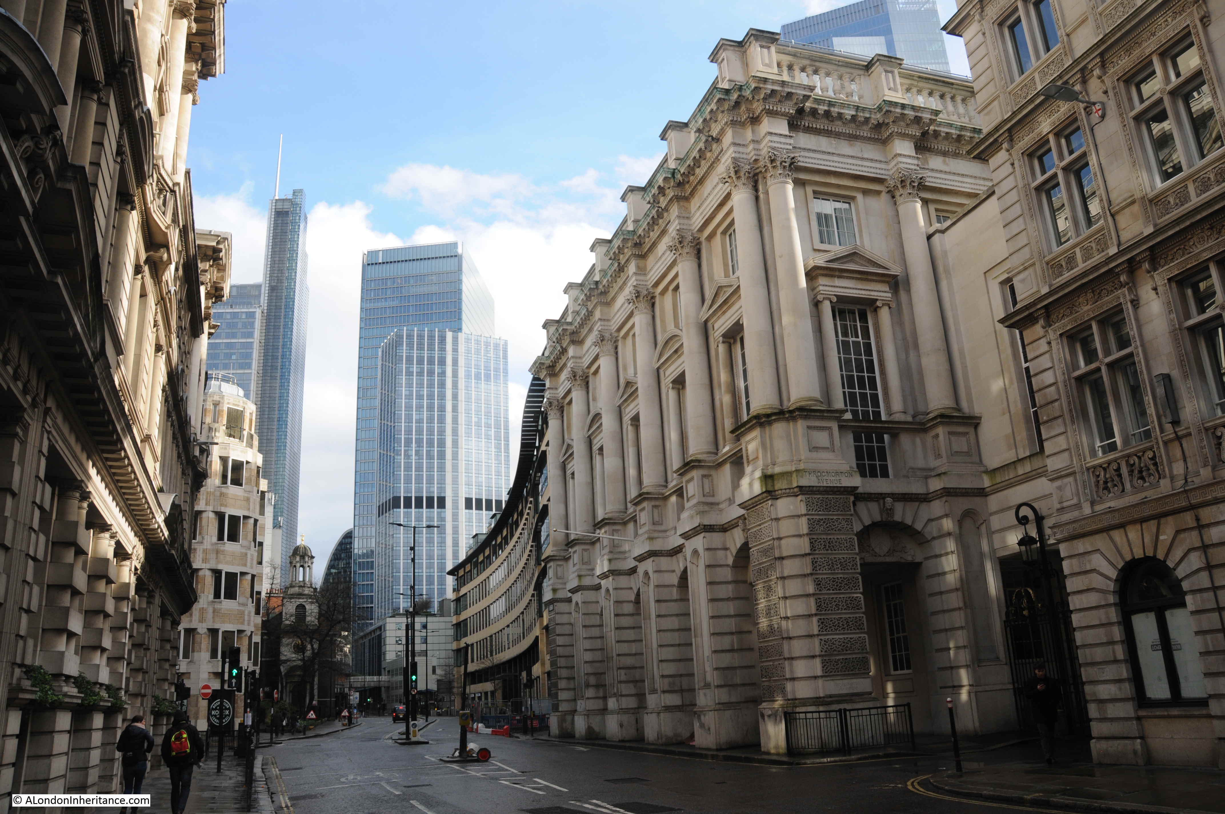
The Carpenters’ have had their hall on this site in London Wall since 1429. The hall today is the third hall, as the previous hall had been badly damaged during the war.
On the opposite side of the street, old and new buildings sit on opposite corners.

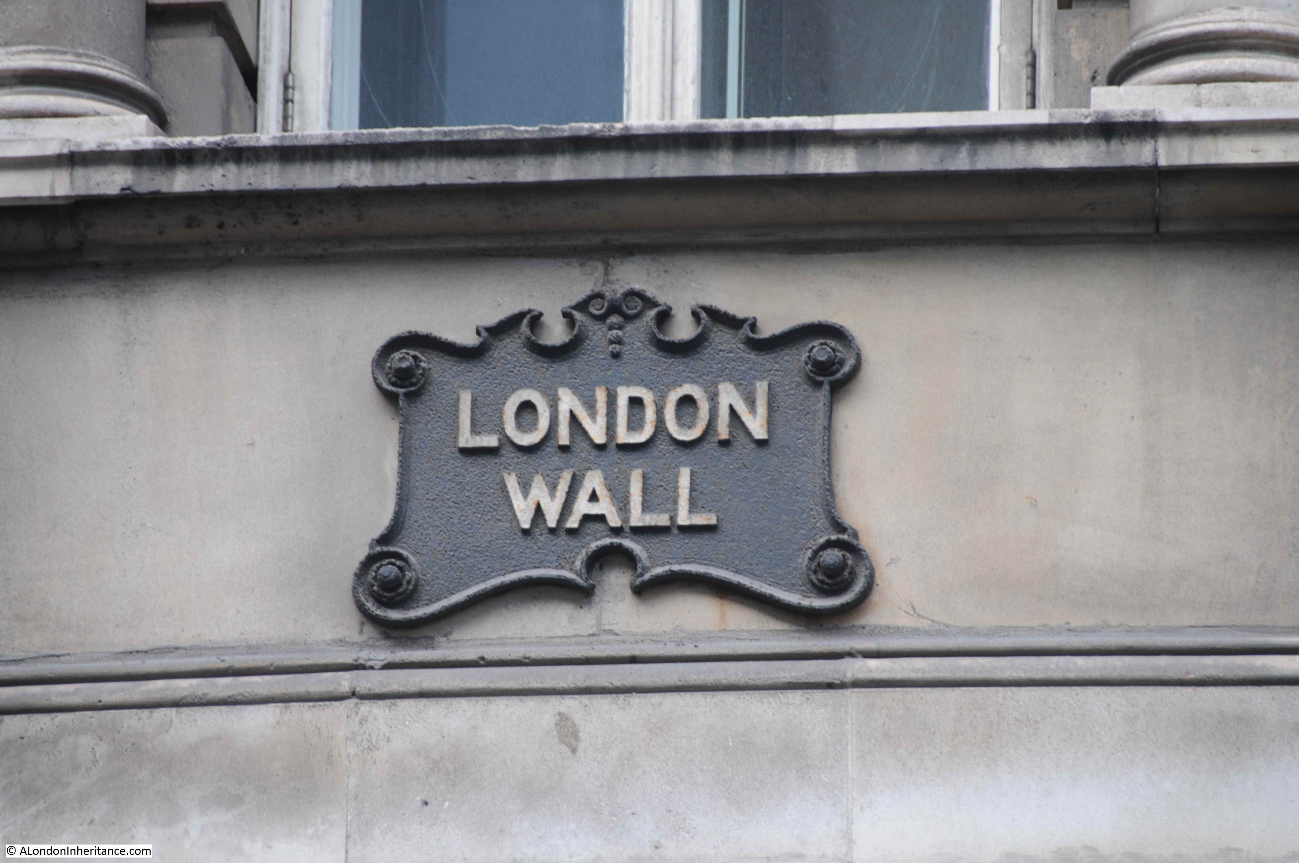
The building on the left in the above photo still has original London Wall street signs. Not sure of the exact age of these, but they must be pre-war.
Just east of the Carpenters’ Hall, London Wall widens again from a single carriageway to a dual carriageway, as part of the scheme to create a major through route, however along this part of the street, the widening has not been as dramatic as on the section from Moorgate to Aldersgate Street,
Almost at the eastern end of London Wall is the church of All Hallows on the Wall, the name referencing the fact that the church is located up against the Roman wall, with the original church on the site being built on a bastion of the wall.
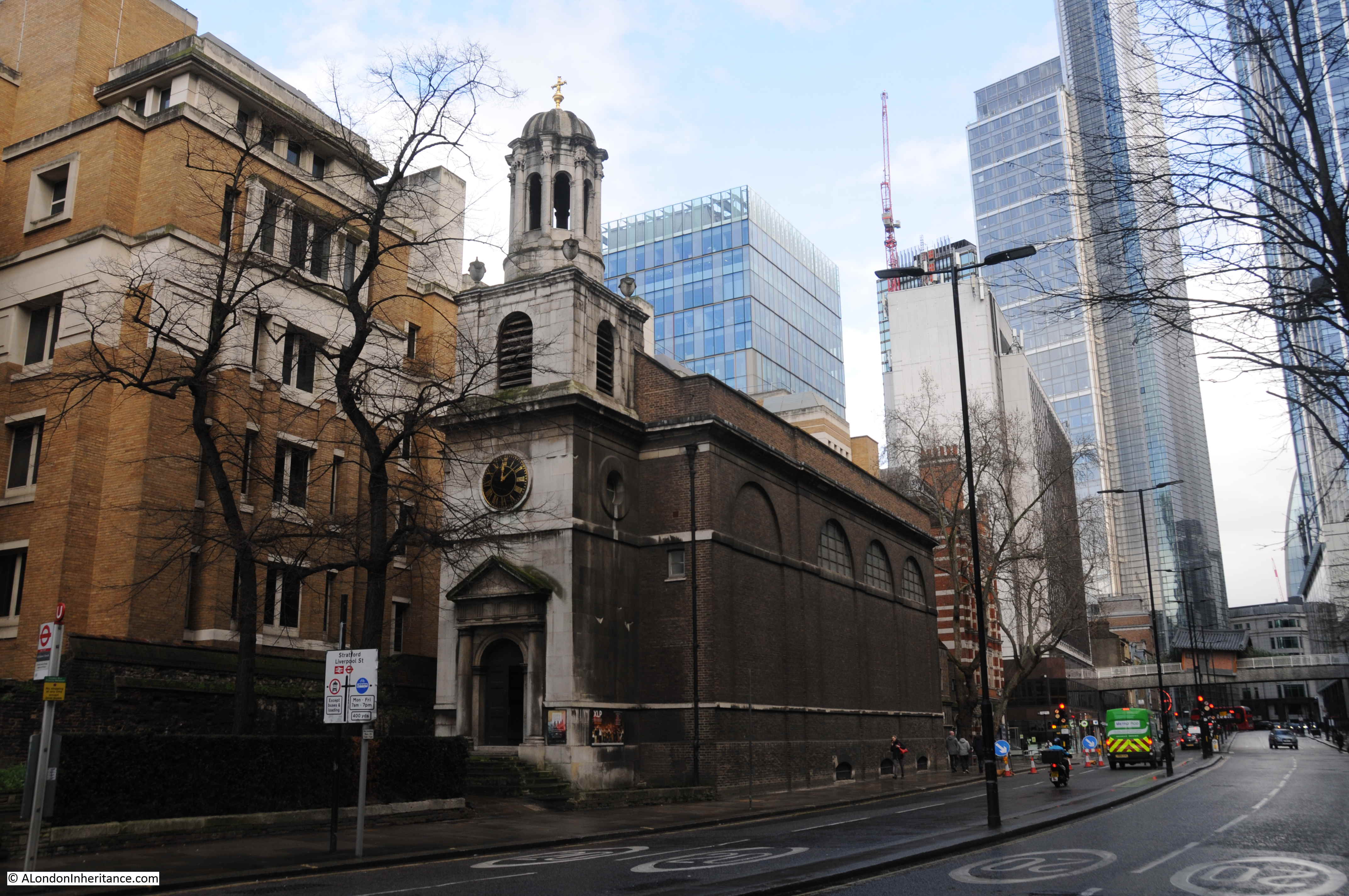
The present church was built in 1767 to replace the earlier church which had become derelict. The church did suffer damage during the war, but was restored in the 1960s, and is now the Guild church of the Worshipful Company of Carpenters.
A short distance further east from the church, just by the green van and traffic lights in the above photo, London Wall comes to an end, where the road continues as Wormwood Street.
That completes a walk along London Wall. A historic street that originally followed the path of the Roman Wall, but now only does this for the eastern section up to Moorgate. Passing Moorgate, London Wall diverts to the south and becomes a large dual carriageway, reflecting the post-war view that city design had to accommodate the car.
However the magic of London is that we can still find the line of the original London Wall, and that these old routes and boundaries have been retained.
The post London Wall – A Location Shifting Historic Street appeared first on A London Inheritance.
To read the article in English. alondoninheritance.com


